 |
|
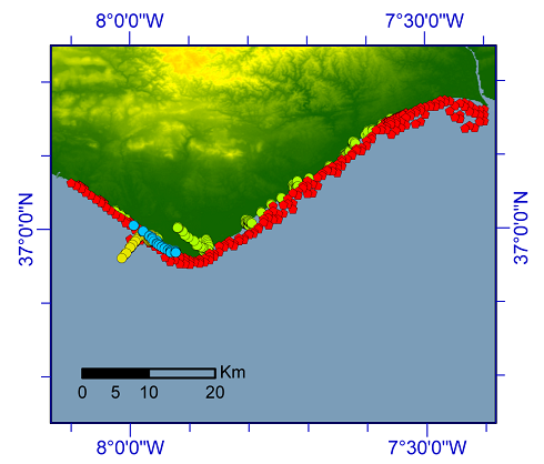
Samples collected within the central sector. Every sample includes available textural information, geographic location, project reference, etc. available within the attribute table.
The distribution of the samples can be consulted by accessing to the different groups (Legend of the Figure). The groups include several projects within which the samples have been collected and analysed. The groups give you direct access to the samples by direct download of the associated *.kmz file into Google Earth.
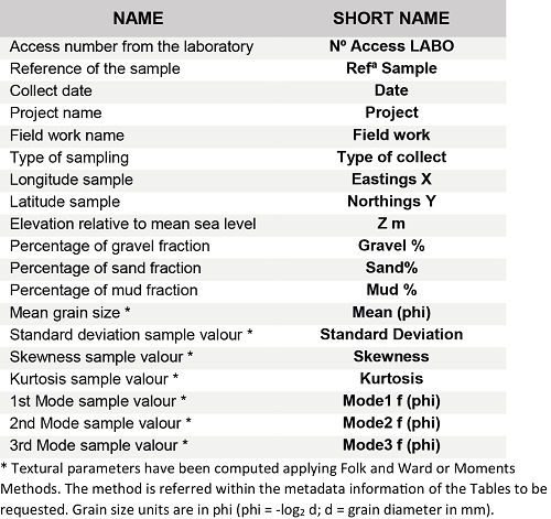
Additional information: The kmz files downloaded into Google Earth contain all available information for each sample. The following summarizes used acronyms and their siginificance.